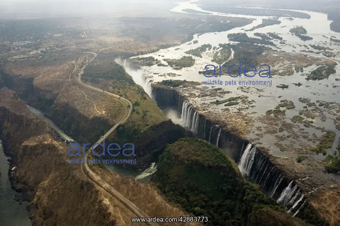
Zimbabwe / Zambia - Aerial view of the Zambezi
Zimbabwe / Zambia - Aerial view of the Zambezi River and the Victoria Falls (1700m wide). From left to right: The Main Falls (93m high, Zimbabwe), Livingstone Island (borderline Zimbabwe/Zambia), the Rainbow Falls (108m, highest falls, Zambia) and the Eastern Cataract (Zambia). On the left the Victoria Falls Bridge which is no-man's-land between the Zimbabwean and Zambian border posts. Early August during the dry season. World Heritage Site
Picture No
10761082
Media ID
42883773
Size
3493px x 2325px
(1.6MB)
Credit
©Thomas Dressler / www.ardea.com
Category
NA
Ardea Picture Library
Picture No
10761082
Contributor Ref
TD-1938